Shortline railroads often inherit low-density LiDAR from multiple vendors. Missing sensor metadata, vegetation, ballast, fences, and uneven terrain make conventional extraction pipelines brittle and difficult to transfer between corridors.
Completed projectMay 2025AI perception · LiDAR engineering
Automated rail extraction from low-density LiDAR
Engineered an AI-driven LiDAR pipeline that combines local geometric filters with a dynamic graph neural network to reconstruct rail geometry from sparse, noisy point clouds without relying on sensor configuration or fixed global rail features.
My roleKey Investigator · Data Contributor · Coauthor
99.32%lengthwise correctness
01 / PROBLEM & CONTEXT
Rail asset and inspection workflows need continuous track geometry, but available point clouds may be sparse, noisy, and collected without reusable sensor configuration metadata.
- AI engineering
- LiDAR
- DGCNN
- Point-cloud engineering
02 / ENGINEERING PIPELINE
How the system moved from raw evidence to a usable decision.
Designed a hybrid pipeline that uses sparsity, density, elevation, and local surface features to reduce the point cloud before DGCNN classification. Three configurations were tested on FRA data averaging 293 points per square meter.
Evidence
Data
FRA rail-corridor point clouds averaging 293 points per square meter, with rail points mixed among ground, ballast, vegetation, fences, and other nearby objects.
Pipeline
Data engineering
Applied sparsity, density, elevation, local-surface, and grid filters to reduce noise and produce compact rail-candidate point sets before classification.
Signals
Data mining
Used local neighborhood geometry to identify spatial structure that distinguishes continuous rails from visually similar linear objects and background clutter.
Model
ML / analytical method
A DGCNN was selected after geometric preprocessing so graph-based learning could focus on informative local relationships instead of the full noisy cloud; three pipeline configurations were evaluated.
Decision
System function
The pipeline automatically isolates rail points and reconstructs continuous track geometry suitable for downstream measurement and inventory work.
Proof
Validation
Pointwise precision and F1 were paired with lengthwise correctness, completeness, and quality so local classification accuracy could not hide breaks in operational track continuity.
Plain-language glossary
Technical terms, made clear.
A dynamic graph neural network that learns relationships among neighboring points instead of treating a point cloud as a flat table.
A continuity measure that checks whether extracted rail segments are correct along the usable track length.
03 / KEY INNOVATIONS
What changed in the engineering approach.
Local-feature filtering avoids assumptions about global rail shape or scanner configuration.
Graph-based learning captures neighborhood geometry after aggressive noise reduction.
Pointwise and lengthwise metrics jointly evaluate pixel-level accuracy and operational track continuity.
04 / TECHNICAL ARTIFACT
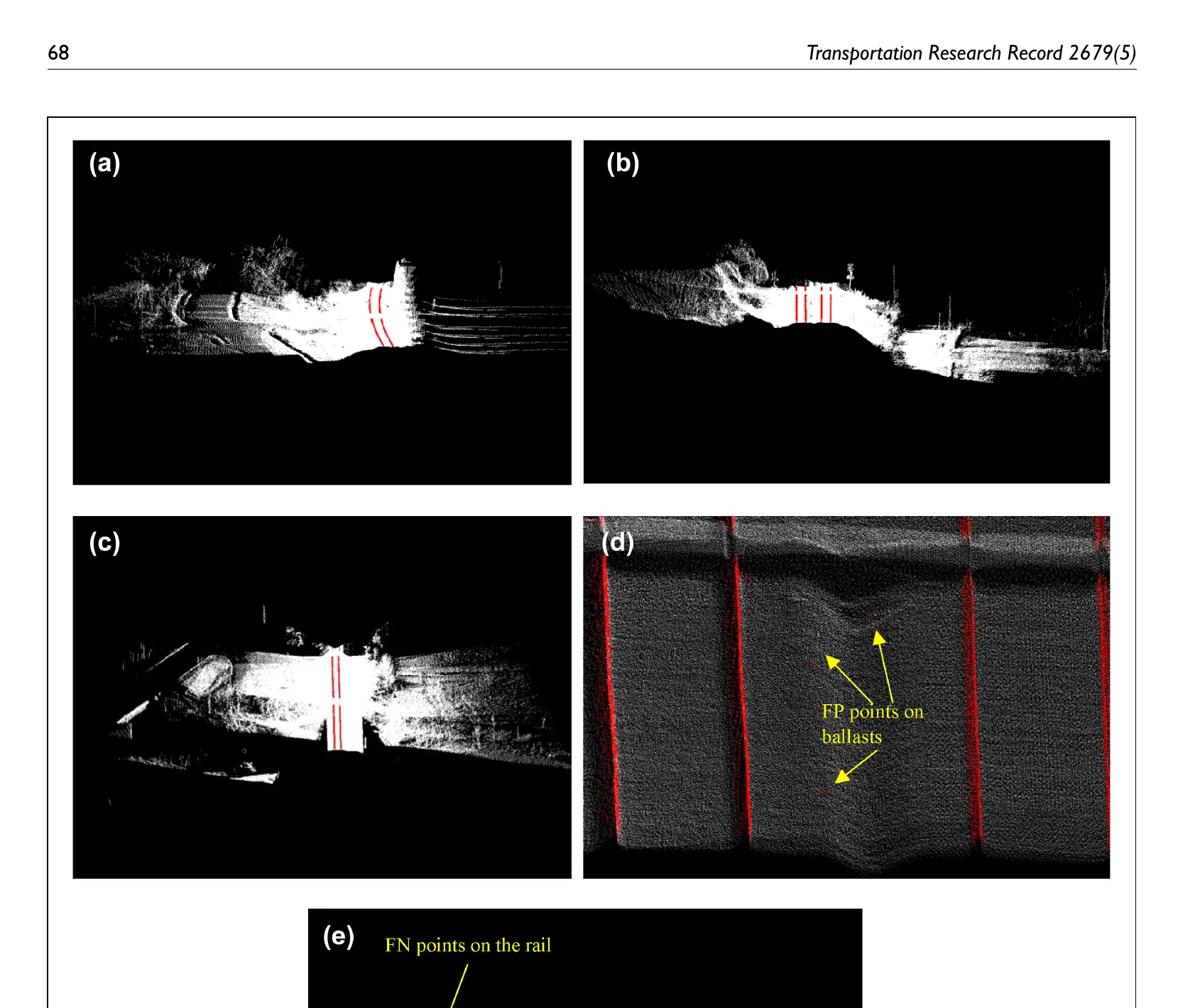
05 / MEASURABLE OUTCOMES
What the system established.
Achieved 0.989 pointwise precision and a 0.852 F1 score.
Reached 99.32% lengthwise correctness, 94.69% completeness, and 94.06% quality.
Operated on low-density data without prior sensor configuration or fixed global geometry.
06 / AGENCY & INDUSTRY IMPACT
Designed to support a decision.
Produces dependable rail centerlines from low-density data without fixed global geometry or prior sensor configuration, expanding the usefulness of existing corridor scans.
Pointwise precision and F1 were paired with lengthwise correctness, completeness, and quality so local classification accuracy could not hide breaks in operational track continuity.
Creates dependable rail centerline inputs for asset inventories, geometry measurement, inspection planning, and infrastructure digital twins.